
Abbotsford eBike Trail Map 2026: 181 km, Trail by Trail

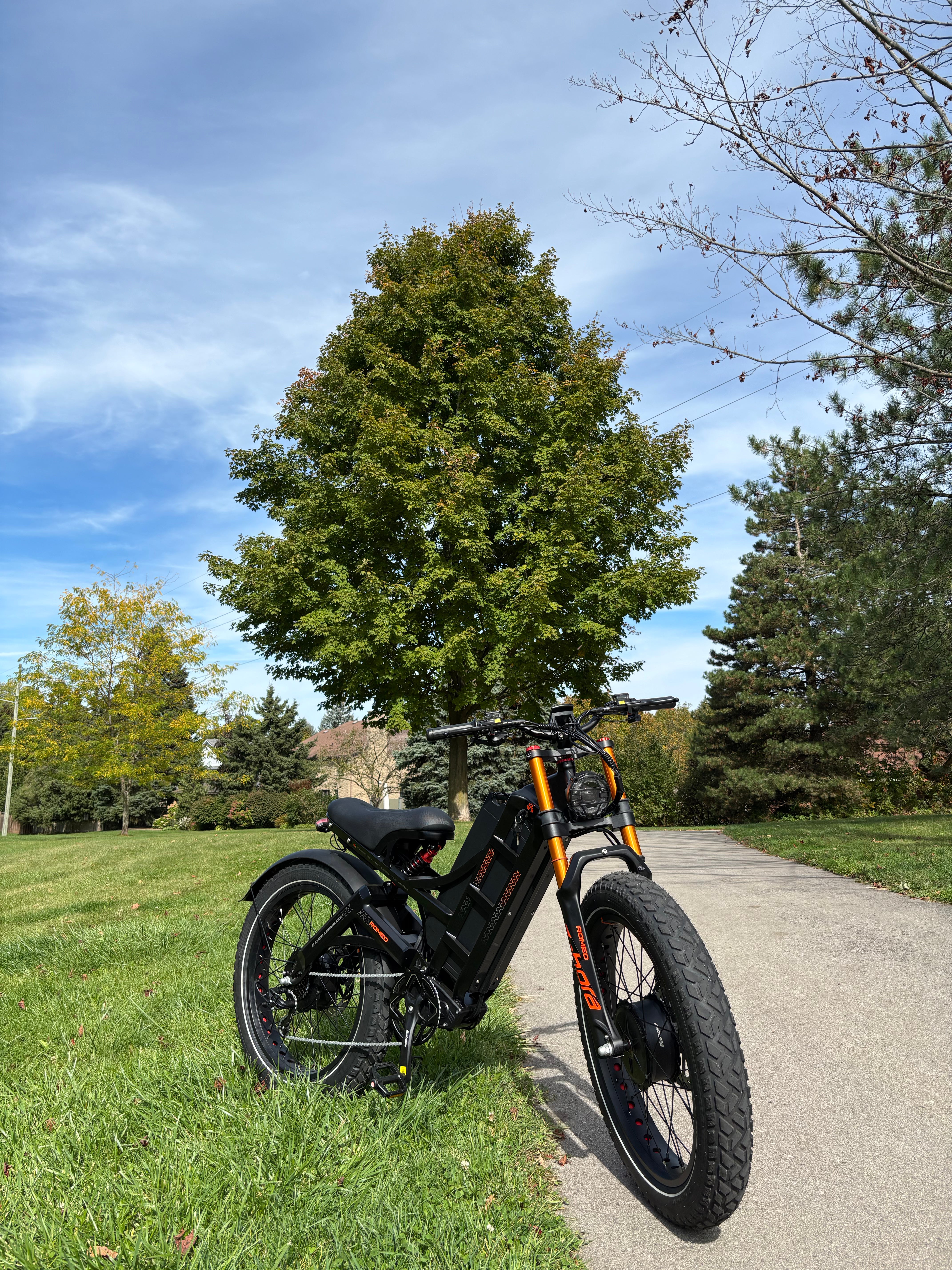
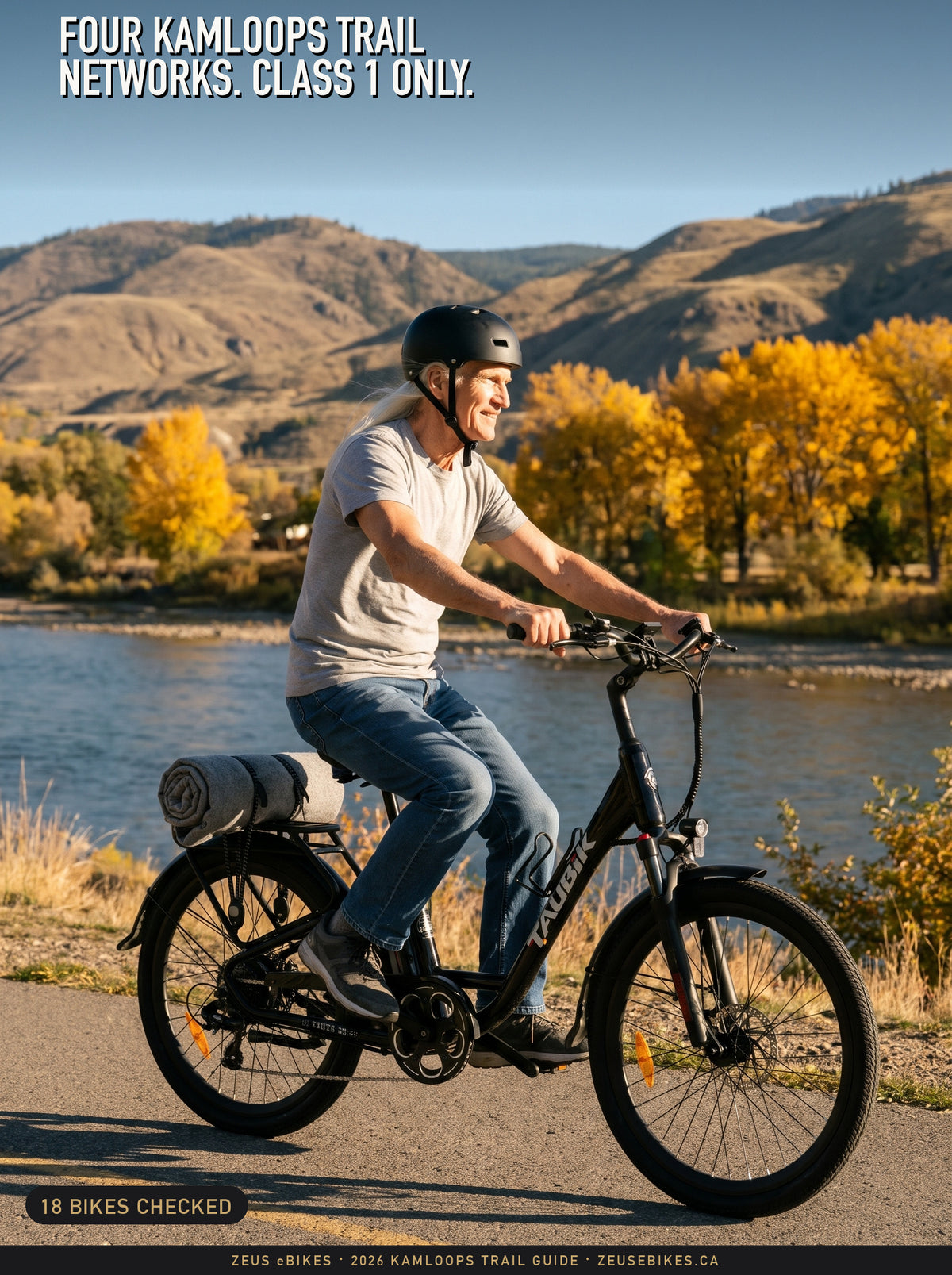
Zeus with the Addmotor CityPro E-43 at Mill Lake Park in Abbotsford: a Playcut.ai rendering made from Addmotor’s own photograph of the CityPro E-43.
An e-bike that meets B.C.’s rules counts as a cycle on City of Abbotsford trails. Of the 181 km on this map, 114 km are City trails open to cycles. FVRD regional parks read two ways (28 km), the Province’s Sumas Mountain bike trails set their own rule (13.5 km), and the Discovery Trail through Hazelwood Cemetery is closed to spring 2027.
Where to buy: step-through e-bikes, electric trikes and our six trail picks ship free from Canada.

Tap the map to open it full screen. Zoom in, tap any trail for its rule, or tap Where am I at the trailhead. Every coloured line is a piece of the City’s Trails layer, coloured by the rule of whoever manages the ground under it. Lengths are our measurement of the City’s lines.
Last updated: 7 November 2026. Every trail rule, bylaw section, closure and bike spec below was read at its source that day. The map lines come from the City’s open data, downloaded on 6 November 2026 and unchanged when we checked again on 7 November 2026.
In this guide
- Can you ride an e-bike on Abbotsford’s trails?
- Six rides to start with
- City trails: Discovery, Mill Lake and the creeks
- Matsqui Trail and the FVRD’s two readings
- The Sumas Prairie dykes
- Sumas Mountain: three managers, one mountain
- Bike lanes, street routes and sidewalks
- Is it an e-bike? The test behind every rule
- Bus racks, Evolve and bike lockers
- Six e-bikes matched to Abbotsford’s trails
- What could change before your next ride
- Every named trail, zone by zone
- Frequently asked questions
- How this map was made
- References
Can you ride an e-bike on Abbotsford’s trails?
Yes on most of them, and this map shows where the answer changes. This summer the City began a new off-road trail strategy and told residents “New mobility technologies are an important focus of the strategy”, so the rules may shift before it finishes in 2027. Ride the wrong stretch and a fine runs from $75 on City trails to $200 in a regional park. So here is all 181 km, sorted by whose rule applies.
Four kinds of land manager decide almost everything here, and the trail does not change colour when you cross from one to the next. The City runs its parks, trails and streets. The Fraser Valley Regional District (FVRD) lists the regional parks at Matsqui, Glen Valley and Sumas Mountain as its own. The Province runs recreation trails on Crown land. First Nations hold reserve land that the Matsqui Trail crosses.
| Where (km on the map) | E-bike that meets B.C.’s test | Who decides, and the source |
|---|---|---|
| City trails and paths: Discovery Trail, Mill Lake, Fishtrap Creek, the Sumas Prairie dykes (99.4 km) | Open as a cycle | City of Abbotsford: Bylaw 3066-2021 ss. 3, 36; Bylaw 2456-2015 s. 26 |
| City nature trails (14.7 km) | Open, low speed | City of Abbotsford: City Trail Guide |
| Matsqui Trail, Glen Valley and Sumas Mountain regional parks (28.0 km) | Two readings | FVRD; the City runs Matsqui: FVRD Bylaw 1500 |
| Sumas Mountain Bike Trails (13.5 km) | Pedal-assist rule; treat as closed to a throttle bike unless a sign opens it | Recreation Sites and Trails BC: RSTBC policy s. 7.2 |
| Reserve land, walking paths, Sumas Mountain lines with no rule we could find (25.3 km) | Ask first; the sign decides | First Nations, City or others: City distance sheet |
| Discovery Trail through Hazelwood Cemetery (0.3 km) | Closed to spring 2027 | City of Abbotsford: City Trail Closures |
| Bert Brink Wildlife Management Area (no City line inside) | Closed all year | Province (Wildlife Act): B.C. Reg. 18/2024 Sch. 1 s. 85 |
| Sidewalks (not mapped) | No, unless a bylaw or sign allows it | Province: MVA s. 183(2)(a) |
How to read the colours
Each colour answers one question: whose rule applies here, and what does it say about an e-bike that meets B.C.’s test. Green means the City’s rule treats you as a cycle. Amber means the text can be read two ways. Blue is the Province. Grey means ask first, and red means closed. Low-speed, two-reading and closed lines also have their own dash pattern, so they read without colour.
On the live map, tap a colour at the foot of the screen to hide it, search any trail by name, and tap Where am I to see the nearest trail and its rule. Your location stays on your phone, and once this page has loaded the map keeps working if your signal drops. Lengths are our measurement of the City’s lines, so they differ a little from the figures the City prints, and both are given where riders ask. We left the City’s single 67.7 km Trans Canada Trail line out of the totals because it runs on top of other trails and streets.
Six rides to start with
Start on green and paved, then work out to gravel. The City’s lake and creek loops are the easiest way to learn a new bike, and the Sumas Prairie dykes give you long, flat distance. These six are our choice, with lengths from the City’s own guide, its distance sheet and Trails BC. Tap a ride to see it on the live map.
| Ride | Length and surface | Where to start | Rule |
|---|---|---|---|
| Mill Lake loop | 2.2 to 2.3 km around the lake, paved | Mill Lake Park’s parking lots | Open |
| Fishtrap Creek | 2.2 km north and 1.6 km south, paved | Fishtrap Creek Park’s parking lots | Open |
| Discovery Trail, Gardner Park to Abbotsford Exhibition Park | 10 km one way, mostly paved | Gardner Park | Open |
| Sumas River Dyke | 8.10 km in the City’s guide, level gravel | Barrowtown Pump Station or Hougen Park | Open |
| Matsqui Trail | 16.86 km, gravel | Mission Bridge day-use area | Two readings: read the trailhead sign first |
| North Abbotsford loop | 47 to 50 km, trail and street | Trails BC’s map | Two readings on the Matsqui part |
Trails BC offers its loop as GPX and KMZ downloads, so you can load it on a phone or bike computer. For the long rides, plan your battery: our US sister store, RedTail eBikes, works out range from the pack and the speed and then plans on 75% of the computed figure.
City trails: the Discovery Trail, Mill Lake and the creeks
On City land an e-bike that meets B.C.’s test rides as a cycle. The Street and Traffic Bylaw says a cycle “has the same meaning as in the Motor Vehicle Act”, and that Act’s definition of a cycle includes “a motor assisted cycle”. So the City’s rules for cycles apply to you on the 114 km of green trail.
The rules on a shared path are short. Section 36(3) says a person riding a cycle “on a multi-use pathway or trail” must yield to pedestrians, give an audible signal by voice, bell or another device before passing, and ride with due care (Bylaw 3066-2021). A breach is a $75 penalty by bylaw notice (Bylaw 3017-2020 s. 7). The City’s etiquette adds that “Bike riders yield to both hikers and horseback riders”.
The parks bylaw treats you like any other rider. It defines a vehicle as any device that carries a person on a path, “irrespective of the mode of power”, so it draws no line between an e-bike and a pedal bike. Section 26 keeps vehicles on the trails provided for them, off any path “reserved for pedestrian traffic”, and at a speed “consistent with safety” (Bylaw 2456-2015). It sets no number, and neither bylaw uses the word e-bike.
The City’s guide tells you what each surface is for. Multi-use trails are paved and suit bicycles. Recreation trails are gravel, “designed primarily for pedestrians and bicycles”, with grades from flat to 15%. Nature trails are under 1.5 m wide and suit “low speed off-road cycling” (City Trail Guide). The 4.9 km the City’s data calls walking paths are not in that guide’s list, so treat those as a question for the sign.

Central Abbotsford. The red marker shows the Discovery Trail closure at Hazelwood Cemetery.
The Discovery Trail
The Discovery Trail is the City’s “paved corridor spanning through the community”, with level to moderate grades and four seasons of use. The map in its Trail Guide labels five sections that add up to 18.8 km, running from Fishtrap Creek Park through Clearbrook and Exhibition Park to Willband Creek, then east to Lower Sumas Mountain Park.
The City’s open data shows what those labels leave out. Its Discovery line runs about 27 km end to end: about 18.6 km on trail, which agrees with the guide’s 18.8 km, and about 8 km on streets that join the trail sections (our measurement, after removing about 1.6 km the layer draws twice). Only about 0.6 km of those streets carries a City bike route. The longest links are on Bell Road, Hallert Road and Bateman Road, so ride those as roads, with traffic.
Two gaps matter, and the first is a closure. Since September 2026 the “Discovery Trail section through Hazelwood Cemetery is temporarily closed” for the Maclure Road Extension Project, with completion expected in spring 2027, and the project adds a new multi-use pathway connection (City Trail Closures). The City’s notice names no detour. Its Cycling Routes layer shows the Hazelwood-Elmwood-Maclure painted bike route passing within about 60 m of both ends of the closed section (our overlay), so look there first and follow the site signs.
The second gap is Highway 11. A resident asked the City’s trail project for a bridge, saying there is no safe way across the highway between the sections. The City called that “a recurring theme in public feedback” (City trail strategy page).
Mill Lake, Fishtrap Creek and the creek trails
Mill Lake’s paved loop is 2.30 km in the City’s guide and 2.2 km on its distance sheet. Fishtrap Creek’s paved trails run 2.2 km north and 1.6 km south on that sheet, and Willband Creek’s gravel loop is 3 km. City winter care is limited: “Snow and ice are generally not cleared from our pathways or trails”, and bridge and boardwalk decks can be very slippery at all times of year. Our e-bike battery guide covers the cold and wet.

West Abbotsford, where most of the City’s short neighbourhood trails sit.
Park hours
City parks close at night. Section 17 bars anyone from being in a park between one hour after sunset and one hour before sunrise, and the bylaw counts trails for biking as park (Bylaw 2456-2015). A multi-use path that is part of a road is not park, so a commute on a street route is not caught. Check your lights: the Motor Vehicle Act wants a white front light and a red rear light and reflector from half an hour after sunset (s. 183(6)).
Aldergrove Regional Park
Aldergrove Regional Park straddles the city line, and Metro Vancouver kept it when Abbotsford left its parks service (2017 release). Its park page lists cycling (Metro Vancouver), and a 2025 staff report says “e-bikes will be permitted on any trails or greenways that are currently designated by posted notice as allowing human-powered cycles” (staff report). The bylaw’s wording reads narrower, as our Vancouver guide explains, and the City’s Trails layer holds no lines there, so this map leaves it uncoloured.
Want a bike for the Discovery Trail?
Our six picks are listed inside B.C.’s limits on their makers’ Canadian sites, from $1,399. Free shipping across Canada, and a real person on 1-866-938-7580.
See the six bikes →Matsqui Trail and the FVRD’s two readings
On the Matsqui Trail the rule is unsettled, so its 12.5 km are amber on this map. The FVRD says the park became its regional park in 2017 and that the City has maintained and operated it since. The City lists the park as open to biking, while the FVRD’s bylaw can be read to keep any motor off the trail, and neither one mentions e-bikes there.
It helps to know how the park got here. Metro Vancouver used to run it, and a 2017 agreement let the City leave Metro Vancouver’s parks service and transferred Matsqui Trail, Sumas Mountain and the eastern part of Glen Valley to the City (2017 release). The City’s page now gives 16.86 km: “9.16km of gravel dike trail and 7.7km of gravel foreshore trail”, “Accessible for horseback riding, biking and walking”, open from 6 a.m. to 8 p.m. (City Trails page). It also lists 12 picnic tables, 8 firepits and 4 pit toilets, and calls the park a popular spot for shoreline sturgeon and salmon fishing.

The Fraser shore. Amber trails sit in FVRD regional parks; the marker shows where riders dismount for the route under the railway.
FVRD Bylaw 1500 defines a motor vehicle as “a motorized device by which a person or thing may be transported”, and it has no section on bicycles or e-bikes. Section 10.1 keeps a motor vehicle to roadways, parking areas and areas with posted notices allowing it, and section 10.2 wants it licensed and registered. It calls a trail a route for “pedestrian or other non-motorized traffic” (Bylaw 1500). On that reading an e-bike stays off the trails unless a posted notice opens them, and the penalty for travelling off road is $200, or $190 paid early (Schedule A-5).
The other reading: the bylaw’s “Park” leaves out land that falls “under other regulatory bylaws”, and Abbotsford’s parks bylaw covers land under the jurisdiction of “the Fraser Valley Regional District (where such are located with the boundaries of the City)”, where a device counts the same whatever powers it. The FVRD’s own transportation plan calls active transportation “non-motorized transportation modes such as walking, cycling, rolling, mobility aids, e-bikes and e-scooters” (FVRD ATNP).
We found no FVRD or City statement that settles it, and a text on a planning page is not a bylaw. Read the sign at the trailhead, and if you want an answer in writing, parks@fvrd.ca is the FVRD’s published address.
The railway underpass
The dike northeast of the Mission Bridge day-use area lost its at-grade rail crossing for good at the end of November 2024, because it did not meet Transport Canada’s regulations. The FVRD asks riders to “dismount your horse or bicycle before using the new trail route under the railway” (FVRD notice). The marker on the map shows the spot, our placement from the railway and trail lines.
First Nations land and Glen Valley
West of the Mission Bridge the route crosses Matsqui Main 2, reserve land of Matsqui First Nation: 2.0 km on our overlay of Douglas Taylor Park Trail, and the City’s distance sheet counts 2.33 km of First Nations land. We found no published rule for that stretch, so it is grey. Treat it as someone’s home: stay on the path and follow the signs.
Glen Valley Regional Park’s 2.0 km sit at the far northwest. The sources differ. The City says the park is co-managed with Metro Vancouver, the FVRD’s map lists it as an FVRD park, and Metro Vancouver’s 2017 release says its eastern part went to the City. The City lists it as a gravel trail “Accessible for walking”, open dawn to dusk, and does not list biking.
The Sumas Prairie dykes
The flat gravel dykes on Sumas Prairie make an easy long ride, and they are City trails, so they are green. The City’s guide says they suit walking, running, cycling and horseback riding “for all levels of fitness”, on “multi-use gravel trails with level grades”, past berry fields and dairy farms (City Trail Guide).
| Dyke trail | The City’s two figures | Our measure |
|---|---|---|
| Sumas River | 8.10 km in its guide; 17.6 km on its sheet, with McKay Creek | 7.15 km |
| Arnold | 7.36 km in its guide; 5.3 km on its sheet | 5.46 km |
| Barrowtown and Vedder | 4.48 km in its guide; 4.2 km on its sheet | 4.44 km |
| McKay Creek | 1.58 km in its guide; inside the Sumas River figure on its sheet | 1.44 km |
The City’s two documents disagree, so we print both, with our own measure of its map line beside them. Park at Hougen Park, the Barrowtown Pump Station or north of Vye Road at Arnold Road, the spots its guide lists. The bylaw makes the east side of the Sumas River between Eldridge Road and McDonald Park and the west side between Eldridge Road and Lakemount Road off-leash dog areas, so slow down and ring early there (Bylaw 2456-2015 Schedule C).

Sumas Prairie. These dykes are City trails with level grades.
On the Fraser north of Sumas Mountain, the Province’s Bert Brink Wildlife Management Area is closed to motor vehicles all year, and the regulation counts an electric bicycle as one (B.C. Reg. 18/2024). No City trail line runs through it on our overlay, so keep your e-bike out of it.
Sumas Mountain: three managers on one mountain
Sumas Mountain is where a throttle bike runs out of road. The FVRD’s regional park, the Province’s bike trails and other land sit side by side, and the named singletrack in the Province’s data is the part with the pedal-assist rule. In all, 13.5 km of the Province’s bike trails are blue, 13.5 km of the FVRD park’s trails are amber, and 16.5 km of lines here are grey because we found no manager’s rule for them.

Sumas Mountain. Blue lines are the Province’s established bike trails; the pale gold area is the FVRD park. The amber also takes in the east end of the Matsqui Trail.
Sumas Mountain Regional Park
The FVRD calls this a 1,471-hectare park with trails that link to a larger network, and it lists mountain biking among its popular activities. It opens from 7 a.m. to sunset, and the road in is “shared with mountain bikes, residents, ATVs, trucks and work vehicles” (FVRD park page). Bylaw 1500’s two readings apply here too. About half the park lies outside the City, where Abbotsford’s parks bylaw does not apply, so on our reading the stricter one is stronger there.
The Province’s Sumas Mountain Bike Trails
The Province’s open data lists these lines (Emma Peel, Squid Line, Rock Diva and others, file REC32319) as established recreation trails, and its policy gives the default. “Class 1 e-bikes / MAC are permitted on Established Recreation Trails open to non-motorized use” unless e-bikes are specifically prohibited, while “Class 2 and 3 e-bikes are not permitted on Established Recreation Trails that prohibit motorized vehicles”. It defines a Class 2 bike as “throttle equipped” (RSTBC policy).
The policy mentions “MAC”, which can include a throttle bike, so a rider could argue the point. We would not. We found no public page for this trail file on the Province’s site and no order saying which uses it allows. If your bike has a throttle, treat these trails as closed unless a sign opens them.
The Centennial Trail and the forest road
The Province’s page for the Centennial Trail says its eastern trailhead is marked “trail closed” just past Chadsey Lake because part of the trail is destroyed (RSTBC Centennial Trail). The Sumas Mountain Forest Service Road belongs to the Ministry of Forests, and the City says its gate is “currently in a locked-open position” (City Trails page).
Ledgeview and the McKee trails
Ledgeview’s hiking and mountain-bike trails sit “on the west side of Sumas Mountain” (Vancouver Trails), and no line in the City’s Trails layer or the Province’s trail file carries that name. The Fraser Valley Current reported in July 2025 that “Almost all the trails are located on private land and tolerated by property owners”, and that a development south of Ledgeview Golf Course will give the City one hectare of parkland with the trailhead (Fraser Valley Current). We found no e-bike rule for these trails. On private land the owner decides, so ask first.
Bike lanes, street routes and sidewalks
On the street an e-bike that meets B.C.’s test rides by the same rules as a pedal bike, and about 170 km of Abbotsford’s roads carry a City bike route. We count each road once there, because the City draws most routes one direction at a time. Most of its lines are road shoulder. Painted or buffered lanes come next, and the City’s protected lanes are still short: 2.8 km on Marshall Road, Salton Road and the Parkview-Tims-Charlotte Bikeway.

Every route in the City’s Cycling Routes layer, by type. Darker blue means more separation from traffic.
| Type of route (City’s label) | km of line in the City’s layer |
|---|---|
| Bicycle Accessible Shoulder | 172.4 |
| Painted or Buffered Bicycle Lane | 86.9 |
| Trail (also on the trail map) | 29.4 |
| Shared Street | 8.0 |
| Multi-Use Path | 6.2 |
| Protected Bicycle Lane | 2.8 |
| Neighbourhood Bikeway | 2.7 |
A road with a shoulder or lane on each side counts twice in this table. The five on-street types add up to 273 km of line, and with the trail and multi-use path lines the layer holds 308 km. Two checks put the roads themselves at about 170 km: overlaying the lines gave 165 to 178 km, and adding each street’s longer direction gave 168 km (our measurements).
Stay off sidewalks. The Motor Vehicle Act says a person operating a cycle “must not ride on a sidewalk unless authorized by a bylaw made under section 124 or unless otherwise directed by a sign” (s. 183(2)(a)), and we found no section of the City’s traffic bylaw that authorizes it. Walk across a crosswalk too, unless it is marked or signed for cycles: the City’s section 36(1) bars riding in one, and that carries the same $75 penalty.
A helmet is required on a highway (MVA s. 184), and it must meet a standard listed in B.C. Reg. 234/96. The City’s page also reminds riders that a “bike lane is a 1.2 - 2.0 metre wide striped lane”, and that “Motorists turning right must yield to cyclists in the bike lane” (City Bike Lanes).
Is it an e-bike? The test behind every rule on this page
Every “yes” above depends on the bike being a motor assisted cycle under B.C. Reg. 64/2024. It needs motors rated 500 W or less “in total” (s. 3(1)), no assistance past 32 km/h on a clean, paved and level surface (s. 3(2)(a)), a motor that stops when you stop pedalling, release the throttle or brake (s. 3(2)(b)), a separate mechanism that controls the motor if it has a throttle (s. 3(2)(c)), “only 2 or 3 wheels” and wheels at least 350 mm across (s. 4).
A standard e-bike rider is 16 or older on a highway (s. 9); a light e-bike (250 W, 25 km/h, no throttle) rider is 14 or older (ss. 6 and 8).
Section 3(2)(a) says the motors “must not be capable of propelling the device at a speed exceeding 32 km/h” on a clean, paved and level surface (B.C. Reg. 64/2024). Read plainly, a bike set to stop assisting at 32 km/h meets it. Read most strictly, a motor that a speed setting can make go faster is capable of more than 32 km/h whatever it is set to, which would put the bike outside the definition.
The regulation does not say which reading applies. On either reading, a bike whose assistance is set above 32 km/h is not an e-bike under B.C. law.
A machine that fails the test is not a cycle, and the City’s traffic bylaw says a motor vehicle may run only on a highway or on private property with the owner’s consent (s. 69).
E-scooters are a separate case. Abbotsford is not on the Province’s list of pilot communities, and on 1 September 2026 the Abbotsford Police Department said electric kick scooters “are not permitted on public roads, sidewalks, pathways, or parks anywhere within the City of Abbotsford”, that “Their use is restricted to private property”, and that riding one can bring a $109 fine, with enforcement stepped up at local parks (the notice as carried by Fraser Valley News Network).
Getting there: bus racks, Evolve and bike lockers
Plan to roll or drive to your trailhead, because the bus takes only a light e-bike. BC Transit carries electric bicycles on the rack only when they weigh less than 25 kg (55 lb) and the lithium battery comes off and aboard with you, and it bars moped-style e-bikes. Community-bus racks work in daylight only (BC Transit). Our six picks are listed at 29 to 39 kg. BC Transit does not say whether the battery counts toward the limit, so weigh yours without it first.
For a short trip, BCAA’s Evolve E-Bike Share came to Abbotsford in June 2026 with “20 Evolve E-Bikes” at six parking zones: College Park, Bevan Grove Apartments, Central Park Village, Clearbrook Plaza, Montecito Place and Marshall & Horizon. Trips begin and end at those zones, and the regular rate is $1.25 to unlock plus 35 cents a minute (BCAA).
The City rents bike lockers at the Montrose Transit Exchange from $12.50 plus GST a month, with a $35 key deposit. They are for daily use only, so nothing stays overnight, and the City asks you to check your bike fits first (City Bike Lockers). Our e-bike theft protection guide covers locks and insurance, and our Abbotsford e-bike shop guide lists the stores in town.
Six e-bikes matched to Abbotsford’s trails
These six are e-bikes we sell whose makers’ Canadian pages list a motor rated 500 W or less and a top speed of 32 km/h or less, read again on 7 November 2026. We chose them for the surfaces in the City’s own data: paved trails and bike lanes, gravel dykes and recreation trails, and a trike for the flat ground. As listed, each is inside B.C.’s motor and speed limits and may ride Abbotsford’s green trails.
In the owner’s manuals we read, two of the six have a speed setting the owner can change: the Taubik Vista 26 and the Samebike RS-A02 Pro. Their cards link the manual: keep the setting at 32 km/h or less in B.C. (see the strongest reading in the test section). The manuals for the Blackburn 275T and Westridge 29T describe no such setting, and Addmotor says a manual comes with each bike, but we found none published online for the CityPro E-43 or the Citytri E-310, so for those two we cannot say.
Each has a throttle, so none is a pedal-only trail bike. On delivery, check that the motor stops when you brake (s. 3(2)(b)). The groups are our view of where each bike rides best, and where a maker prints two load figures, plan on the lower.
For the paved Discovery Trail, Mill Lake and bike lanes
The City’s paved trails add up to 37 km on this map, and its bike routes cover about 170 km of streets.
Addmotor CityPro E-43
$1,399 CAD
A 26-inch commuter whose 2.3-inch tires suit the paved Discovery Trail, Mill Lake and the City’s painted bike lanes, with enough width for a gravel link between them. Addmotor Canada’s page prints two batteries: 48V*15Ah in its spec table and a “48V*20Ah UL-certified Battery” in another line, so confirm the one you are buying.
It has a half-twist throttle, and Addmotor’s range figure is 201 km on PAS 1, printed beside the 20 Ah line. Specs from Addmotor’s Canadian page, read 7 November 2026.
B.C. check: Addmotor Canada lists a 500 W motor (907 W peak) and 32 km/h; B.C.’s 500 W limit applies to the continuous rating (s. 3(1)), not the peak.
Taubik Vista 26
$2,399 CAD
A low step-through frame on the narrowest tires of the six, for the paved Discovery Trail, the Mill Lake loop and errands along the bike lanes.
It has a thumb throttle, per Taubik’s manual and brochure, and Taubik’s range figure is up to 100 km. Specs from Taubik’s Canadian page, read 7 November 2026.
B.C. check: Taubik lists 500 W and 32 km/h. The owner can change the speed setting (Taubik’s Vista manual), so keep it at 32 km/h or less in B.C.
For the gravel dykes and recreation trails
Gravel is the biggest surface on City trails: 60 km on this map.
Taubik Blackburn 275T
from $2,799 CAD
Bigger 27.5-inch wheels and 2.35-inch tires roll more calmly over the City’s gravel dykes, which its guide lists with level grades, and still feel at home on the paved Discovery Trail.
It has a thumb throttle, per Taubik’s manual and brochure, and Taubik’s range figure is up to 100 km. Specs from Taubik’s Canadian page, read 7 November 2026.
B.C. check: Taubik lists 500 W and 32 km/h.
Taubik Westridge 29T
$2,999 CAD
The tallest wheels of the six, 2.4-inch tires and a front suspension fork for rougher gravel and the City’s recreation trails, where grades can reach 15%. It has a mountain-bike frame, but it has a throttle, so it is not sold here as a bike for the Province’s Sumas Mountain trails.
It has a thumb throttle, per Taubik’s manual and brochure, and Taubik’s range figure is up to 100 km. Specs from Taubik’s Canadian page, read 7 November 2026.
B.C. check: Taubik lists 500 W and 32 km/h, and its manual says “The maximum speed of this E-Bike is 32 km/h.”
Samebike RS-A02 Pro
$1,399 CAD
Four-inch tires with front and rear suspension for loose gravel, and a frame that folds for the drive out to Hougen Park or the Barrowtown Pump Station, two of the City’s listed dyke parking spots. Samebike’s US page lists the fold at 990 × 550 × 790 mm (RedTail’s review), and at 33 kg it is a heavy lift, so measure your trunk and plan the lift first. On Samebike’s US drawing, RedTail’s fit model puts the saddle at the right height for 93 to 99 of every 100 riders from 5′6″ to 5′10″, 85 at 6′0″ and 46 at 6′2″ (fit section).
Samebike Canada says a charge gives a “55km pure electric range or up to 110km assisted range”, tested by a 75 kg rider on a flat road, so the motor runs without pedalling. RedTail’s model of the US bike, which shares this 48 V 15 Ah pack, computes about 69 km (43 miles) on the throttle at 24 km/h (15 mph) for an 82 kg (180 lb) rider on level pavement, and it plans on 75% of any computed figure (range section). Specs from Samebike’s Canadian page, read 7 November 2026.
B.C. check: Samebike Canada prints 500 W in its spec list and 250 W in a feature line, and 32 km/h: both motor figures are inside B.C.’s 500 W limit. The owner can change the speed setting (Samebike’s RS-A02 Pro manual), so keep it at 32 km/h or less in B.C.
On three wheels
B.C. Reg. 64/2024 s. 4(a) allows “only 2 or 3 wheels”, so a trike that meets the motor and speed limits is a motor assisted cycle like any two-wheeler.
Addmotor Citytri E-310
from $1,899 CAD
A folding trike rated by Addmotor for 127 kg plus 36 kg of cargo, for riders who want three wheels under them on the flat, level dykes and the paved loops around Mill Lake and Fishtrap Creek. It comes in two sizes: Addmotor’s chart puts the Standard at riders 5′1″ to 5′9″ and the Plus at 5′3″ to 6′1″. Addmotor lists it at 71.9 cm wide, or 73.7 cm for the Plus, which matters on nature trails under 1.5 m wide. The from price is one colour and size; the others list at $2,399 to $2,499.
It has a half-twist throttle, and Addmotor’s range figure is 145 km on PAS 1. Specs from Addmotor’s Canadian page, read 7 November 2026.
B.C. check: Addmotor Canada lists a 500 W rear-drive motor and 32 km/h.
Not sure which suits your ride?
Tell us where you ride and we will help you pick. Call 1-866-938-7580 and a real person answers.
Browse Zeus’s e-bike collection →What could change before your next ride
Two bodies could make Abbotsford’s rules clearer, and both are planning now. The City’s off-road trail strategy is in its options stage through fall and winter 2026, with a draft in spring and summer 2027 and a final version in summer and fall 2027. Asked about e-bikes, its team said it is weighing “where different users can be safely accommodated”, along with signage, speed management and enforcement (City trail strategy page).
The FVRD’s Parks and Trails 2050 plan is at its second phase of public engagement. Its 2025 user survey counts “Bicycle / e-bike / e-scooter” as one way people reach its parks, and neither that report nor the Phase 2 report sets an e-bike rule (FVRD Parks and Trails 2050). If either body changes its rule, this map changes with it.
Every named trail, zone by zone
This list is the map in words: all 130 named trails and paths, with our measured length, the City’s surface and every rule that applies along each one. Open a zone, then tap a trail to see it on the live map. Unnamed pieces are on the maps and in the totals but not in these tables.
Two rows need a note. The City’s layer names only 1.49 km as Discovery Trail, because most of the route carries the name of the park it crosses, such as Exhibition Park Trail and Fishtrap Creek South. And it draws the whole Sumas Mountain network under one name, so that row’s 43.50 km crosses three kinds of rule. We fixed a few spellings in the City’s labels, such as Hougan to Hougen.
Central: Mill Lake, Downtown and McKee (80 trails)
| Trail | Length, surface | What applies |
|---|---|---|
| Mill Lake Park Trail | 4.71 km · paved | Open / Open, low speed / Ask first |
| Downes Bowl Trail | 4.44 km · natural | Open, low speed / Open |
| Willband Creek Park Trail | 4.07 km · gravel | Open |
| Exhibition Park Trail | 2.93 km · paved | Open |
| Old Riverside Park Trail | 2.65 km · paved | Open |
| Clayburn Creek Trail | 2.36 km · gravel | Open |
| Cassiar Park Trail | 2.23 km · paved | Open / Open, low speed |
| Mill Lake Loop Trail | 2.20 km · paved | Open |
| Straiton Trail | 2.03 km · gravel | Open / Open, low speed |
| DeLair Park Trail | 1.94 km · paved | Open |
| Valley Road Trail | 1.89 km · paved | Open |
| Stoney Creek Trail | 1.55 km · gravel | Open |
| Discovery Trail (pieces named only that) | 1.49 km · not stated | Open |
| Vicarro Trail | 1.44 km · paved | Open |
| McKee Park Trail | 1.37 km · gravel | Open |
| Civic Centre Trail | 1.15 km · walking path | Ask first |
| Horn Creek Trail | 1.14 km · gravel | Open |
| Ravine Park Trail | 1.09 km · gravel | Open |
| Lower Sumas Mountain Park Trail | 1.08 km · gravel | Open / Open, low speed |
| Berry Park Trail | 1.00 km · gravel | Open / Ask first |
| Abbotsford Exhibition Park Trail | 0.97 km · walking path | Ask first |
| Whatcom Trail | 0.80 km · paved | Open |
| Sumas Mtn Rd | 0.78 km · paved | Open |
| Garibaldi Trail | 0.78 km · paved | Open |
| Hazelwood Trail | 0.72 km · paved | Open / Closed for now |
| McCallum Rd Interchange | 0.68 km · paved | Ask first |
| Eagle Mountain Trail | 0.67 km · natural | Open, low speed |
| Eagle Mountain Park Trail | 0.66 km · paved | Open |
| Auguston Trail | 0.63 km · gravel | Open |
| Mountain Village Park Trail | 0.61 km · gravel | Open |
| McKinley Park Trail | 0.60 km · paved | Open / Open, low speed |
| Willband Creek West Trail | 0.58 km · gravel | Open |
| Cedar Springs Trail | 0.57 km · gravel | Open |
| Mathers Park Trail | 0.56 km · gravel | Open |
| Gladwin Park Trail | 0.56 km · gravel | Open |
| Century Park Trail | 0.50 km · gravel | Open |
| Aspen Park Trail | 0.48 km · natural | Open, low speed |
| Rail District | 0.47 km · paved | Ask first |
| Winfield Park Trail | 0.47 km · gravel | Open |
| Clayburn Heritage Trail | 0.40 km · natural | Open, low speed |
| Jubilee Park Trail | 0.38 km · paved | Open |
| Callaghan Park Trail | 0.38 km · paved | Open |
| Palfy Park Trail | 0.36 km · gravel | Open |
| Immel Park Trail | 0.35 km · paved | Open |
| Buckingham Trail | 0.33 km · gravel | Open |
| Glenridge Park Trail | 0.32 km · paved | Open |
| Salton Rd | 0.30 km · paved | Open |
| Jacobsen Park Trail | 0.30 km · gravel | Open |
| Marshall Rd | 0.30 km · paved | Open |
| Babich Park Trail | 0.29 km · gravel | Open / Ask first |
| Munroe Park Trail | 0.28 km · natural | Open, low speed / Open |
| Eastview Trail | 0.28 km · natural | Open, low speed |
| Saddle Park Trail | 0.26 km · paved | Open |
| Dianne Brook Trail | 0.24 km · gravel | Open |
| McKee Creek Trail | 0.24 km · natural | Open, low speed |
| International Friendship Gardens | 0.23 km · walking path | Ask first |
| Larch Park Trail | 0.22 km · paved | Open / Open, low speed |
| Conway And Babich Trails | 0.22 km · natural | Open, low speed |
| Sandy Hill Trail | 0.19 km · gravel | Open |
| 33816 South Fraser Way | 0.18 km · paved | Open |
| McMillan Park Trail | 0.18 km · walking path | Ask first |
| Bateman Park Trail | 0.17 km · walking path | Ask first |
| Dr Thomas Swift School Trail | 0.14 km · gravel | Open |
| Yale Court Park Trail | 0.13 km · walking path | Ask first |
| Country Place Trail | 0.13 km · natural | Open, low speed |
| 2236 McCallum Rd | 0.13 km · paved | Open |
| Musselwhite Cemetery Trail | 0.12 km · walking path | Ask first |
| Angus Campbell Trail | 0.12 km · paved | Open |
| Keats Park Trail | 0.12 km · gravel | Open |
| Ketch Park Trail | 0.10 km · paved | Open |
| Prince Charles Park Trail | 0.08 km · gravel | Open |
| Juniper Trail | 0.08 km · gravel | Open |
| Discovery Park Trail | 0.07 km · paved | Open |
| Verdon Way Trail | 0.06 km · gravel | Open |
| Inspiration Park Trail | 0.06 km · walking path | Ask first |
| Williams Park Trail | 0.05 km · walking path | Ask first |
| Ascott Park Trail | 0.05 km · natural | Open, low speed |
| Silvertree Trail | 0.04 km · walking path | Ask first |
| Grosvenor Park Trail | 0.04 km · paved | Open |
| Garibaldi Park Trail | 0.04 km · paved | Open |
West: Gardner, Fishtrap and Clearbrook (40 trails)
| Trail | Length, surface | What applies |
|---|---|---|
| Upper Maclure Trail | 4.98 km · natural | Open / Open, low speed / Ask first |
| Clearbrook Park Trail | 3.41 km · gravel | Open |
| Fishtrap Creek South | 2.70 km · paved | Open / Ask first |
| Southern Park Trail | 1.89 km · natural | Open, low speed / Open |
| Albert Dyck Park Trail | 1.73 km · gravel | Open |
| Gardner Park Trail | 1.58 km · gravel | Open |
| Townline Hill Park Trail | 1.31 km · gravel | Open / Ask first |
| Promontory Trail | 1.29 km · natural | Open, low speed / Open |
| Homestead Trail | 1.23 km · paved | Open |
| Parkview-Tims-Charlotte Bikeway | 1.10 km · paved | Open |
| Fishtrap Creek North | 1.05 km · paved | Open |
| Hogan Family Nature Park Trail | 0.85 km · natural | Open, low speed |
| Westridge Pl Trail | 0.65 km · not stated | Open |
| Ponderosa Park Trail | 0.65 km · gravel | Open |
| Grant Park Trail | 0.64 km · gravel | Open |
| Ridgeview Park Trail | 0.60 km · paved | Open |
| Swensson Park Trail | 0.60 km · paved | Open |
| Fishtrap Creek | 0.59 km · gravel | Open / Ask first |
| Spud Murphy Park Trail | 0.52 km · paved | Open |
| Dave Kandal Park Trail | 0.50 km · paved | Open |
| Fairfield Park Trail | 0.46 km · paved | Open |
| Highstreet | 0.42 km · paved | Ask first |
| Pepin Brook Park Trail | 0.35 km · paved | Open |
| Kagidhar Park Trail | 0.33 km · paved | Open / Ask first |
| Sandpiper To Blue Jay Trail | 0.32 km · gravel | Open |
| Matsqui Recreation Centre | 0.28 km · walking path | Ask first |
| Cardinal Ave | 0.28 km · paved | Open |
| Goldfinch Park Trail | 0.27 km · gravel | Open |
| Nadeau Park Trail | 0.25 km · gravel | Open |
| Fishtrap Creek Trail | 0.25 km · paved | Open |
| Rockhill Park Trail | 0.22 km · gravel | Open |
| Charlotte Park Trail | 0.21 km · gravel | Open / Ask first |
| Civic Centre | 0.20 km · paved | Open |
| Homestead Park Trail | 0.20 km · paved | Open |
| Lower Enns Brook Park Trail | 0.17 km · paved | Open |
| South Fraser Way | 0.15 km · paved | Open |
| Monte Vista Park Trail | 0.13 km · natural | Open, low speed / Open |
| Clearbrook Rd Interchange | 0.11 km · paved | Ask first |
| Aero Park Trail | 0.09 km · paved | Open |
| Maclure Park Trail | 0.07 km · paved | Open |
Fraser shore: Glen Valley to Matsqui (4 trails)
| Trail | Length, surface | What applies |
|---|---|---|
| Matsqui Dyke Trail | 9.11 km · gravel | Two readings / Open |
| Douglas Taylor Park Trail | 4.27 km · gravel | Open / Ask first / Open, low speed |
| Gladwin Pond Trail | 0.43 km · natural | Two readings |
| Mt. Lehman Cemetery Trail | 0.08 km · gravel | Open |
Sumas Prairie dykes (5 trails)
| Trail | Length, surface | What applies |
|---|---|---|
| Sumas Dyke Trail | 7.15 km · gravel | Open |
| Arnold Dyke Trail | 5.46 km · gravel | Open |
| Vedder Dyke Trail | 4.44 km · gravel | Open / Ask first |
| McKay Creek Trail | 1.44 km · gravel | Open |
| Hougen Park Trail | 0.31 km · natural | Open, low speed |
Sumas Mountain (1 trail)
| Trail | Length, surface | What applies |
|---|---|---|
| Sumas Mountain Trail | 43.50 km · not stated | Ask first / Two readings / Pedal-assist rule |
Frequently asked questions
Are e-bikes legal in Abbotsford?
Yes, if the bike meets B.C.’s motor assisted cycle test: pedals, motors of 500 W or less in total, no assistance past 32 km/h, 2 or 3 wheels. Abbotsford’s Street and Traffic Bylaw takes its meaning of “cycle” from the Motor Vehicle Act, which includes a motor assisted cycle, so that bike rides City streets and trails as a cycle. Neither the City’s traffic bylaw nor its parks bylaw uses the word e-bike. A bike outside the test is not an e-bike under B.C. law.
Where can I find an Abbotsford trail map?
This page has one: a live map of 181 km of City trail lines that you can zoom, search and tap for each rule, plus a printed map of each zone. The City’s own versions are its online Trail Location Maps, a Parks and Trails Map PDF, a Trail Guide PDF and a Discovery Trail map, all linked from abbotsford.ca/trails, and the Bike Map on its bike lanes page.
How long is the Discovery Trail in Abbotsford?
About 19 km of trail, and about 27 km end to end. The map in the City’s Trail Guide labels five sections of 1.8, 4.6, 2.9, 3.3 and 6.2 km, which add up to 18.8 km, and its distance sheet gives 10 km from Gardner Park to Abbotsford Exhibition Park. The City’s open-data line runs about 27 km once repeats are removed (our measurement): about 18.6 km on trail and about 8 km on connecting streets.
Where do you park for the Discovery Trail?
The City’s Trail Guide map marks parking at five spots along the line: the Gardner Avenue end beside Fishtrap Creek Park, inside Fishtrap Creek Park, Clearbrook Park, Abbotsford Exhibition Park (Maclure Road at Trethewey Street), and the west end of the 6.2 km section at Hazelwood Avenue. It lists a parking lot, picnic tables, benches and public washrooms among the trail’s amenities.
Where is the Matsqui Trail?
Along the Fraser River in the north of the city. The City says the park is located along the shorelines of the Fraser River, and its parks data places it west and east of the Mission Bridge. The FVRD names a Mission Bridge day-use area on the trail.
How long is the Matsqui Trail?
The City of Abbotsford gives 16.86 km: 9.16 km of gravel dike trail and 7.7 km of gravel foreshore trail. Its distance sheet adds 2.33 km through First Nations land and 1.52 km through Douglas Taylor Park.
Can you ride an e-bike on the Matsqui Trail?
The City lists the park as accessible for horseback riding, biking and walking, and it runs the park for the FVRD. It does not mention e-bikes. FVRD Bylaw 1500 reads two ways: a “motorized device” stays off trails unless a posted notice allows it, with a $200 fine, but the bylaw leaves out land that falls under other regulatory bylaws, and Abbotsford’s parks bylaw covers FVRD land inside the City. Read the sign at the trailhead, and ask parks@fvrd.ca if you want it in writing.
Is the Matsqui Trail closed?
The City’s Trail Closures notice, dated September 2026, lists no closure on it. One crossing is gone for good: CPKC closed the at-grade rail crossing on the dike northeast of the Mission Bridge day-use area, and the FVRD asks riders to follow the signs and dismount before the new route under the railway. Park hours are 6 a.m. to 8 p.m.
Are e-scooters legal in Abbotsford?
No. On 1 September 2026 the Abbotsford Police Department said electric kick scooters are not permitted on public roads, sidewalks, pathways or parks anywhere in the city, that their use is restricted to private property, and that riding one can bring a $109 fine. Abbotsford is not on the Province’s list of pilot communities. An e-bike that meets B.C.’s test is a different device, with pedals and a seat.
Can you ride an e-bike on Sumas Mountain?
It depends on whose trail you are on. In Sumas Mountain Regional Park, FVRD Bylaw 1500 reads two ways. On the Province’s established Sumas Mountain Bike Trails, its policy allows a Class 1 pedal-assist e-bike on trails open to non-motorized use and keeps a throttle bike off any trail that prohibits motorized vehicles. Every bike we recommend here has a throttle, so none is sold as a Sumas Mountain trail bike.
Can you ride an e-bike at Ledgeview?
We found no e-bike rule for Ledgeview’s trails on the west side of Sumas Mountain. The Fraser Valley Current reported in 2025 that almost all the trails in that area are on private land and tolerated by property owners, so the owner decides, and we found no published permission for any e-bike there.
Where is the Sumas dyke trail?
On Sumas Prairie in the east of the city. The City’s guide lists the Sumas River Dyke Trail at 8.10 km, the Arnold Dyke Trail at 7.36 km, the McKay Creek Dyke Trail at 1.58 km and the Barrowtown and Vedder Dyke Trails at 4.48 km, all gravel with level grades, with parking at Hougen Park, the Barrowtown Pump Station and north of Vye Road at Arnold Road.
What are the best bike trails in Abbotsford?
For an easy paved ride, the Discovery Trail and the Mill Lake loop. For long flat gravel, the Sumas Prairie dykes. For a big day, Trails BC’s North Abbotsford Cycling Trail Loop joins the Discovery Trail, the Clayburn Creek Park Trail and the Matsqui Trail into a 47 to 50 km journey, part of it in the FVRD’s two-readings park. That choice is our view, and the map shows the rule on each piece.
Is there a bike park in Abbotsford?
The City’s parks bylaw names Mouat Park and McMillan Park as youth parks built for skateboards, longboards, scooters and bicycles, and it requires a safety helmet there. We found no City page that opens them to e-bikes or bars them.
Can I rent an e-bike in Abbotsford?
Yes, by the minute. BCAA’s Evolve E-Bike Share launched in June 2026 with 20 bikes at six parking zones, unlocked in the Evo app, at a regular rate of $1.25 to unlock and 35 cents a minute. Trips must start and end at one of those zones. A web search on 6 November found no Abbotsford shop advertising daily e-bike rentals.
Can I put my e-bike on an Abbotsford bus?
Only on the rack, and only if it weighs less than 25 kg (55 lb) and its lithium battery is removed and carried on board, BC Transit says. Moped-style e-bikes are not allowed, tire limits vary by bus, and racks on community buses can only be used during daylight hours. Our six picks are listed at 29 to 39 kg, and BC Transit does not say whether the battery counts toward the limit.
Can kids ride e-bikes in Abbotsford?
Not a standard e-bike under 16. B.C. Reg. 64/2024 sets 16 as the minimum age to operate a standard e-bike on a highway, and 14 for a light e-bike (250 W or less, 25 km/h or less, no throttle). Every bike on our list is a standard e-bike.
Can you ride on the Trans Canada Trail in Abbotsford?
It is a route, not one trail with one rule. The City’s line for it runs 67.7 km across town, and the Matsqui Trail and the eastern Discovery Trail are on it, Trails BC says, so each stretch follows the rule of whoever manages it: City, FVRD, Province or First Nation.
Before your first ride
Check three things and Abbotsford’s green trails are yours: the bike passes B.C.’s test, you are 16 or older with a helmet, and the line on this map is green. Start with the Discovery Trail or the Mill Lake loop, and try the dykes when you want a longer ride. For a bike whose maker lists it inside B.C.’s limits, start with our six picks.
Zeus ships free across Canada, from Canada. An unused, unopened bike can be returned within 15 days of delivery, less a 15% restocking fee and return shipping. Call 1-866-938-7580 to talk it through with a person, and see our B.C. e-bike law guide for the province-wide rules, or our Richmond and Vancouver trail pages if you ride farther west.
References
Every source below was read on 7 November 2026, and the City’s map layers were last edited on 29 October 2026. City map data contains information licenced under the Open Government Licence – City of Abbotsford. The City of Abbotsford, the FVRD and the Province have not reviewed or endorsed this map.
- City of Abbotsford, Street and Traffic Bylaw, 2021 (No. 3066-2021, last amended 16 June 2026): s. 3 definitions, s. 36, s. 69. Read 7 November 2026.
- City of Abbotsford, Parks Bylaw, 2016 (No. 2456-2015, last amended 31 March 2026): ss. 17, 19, 26; Schedules A and C. Read 7 November 2026.
- City of Abbotsford, Bylaw Enforcement Bylaw, 2020 (No. 3017-2020, last amended 31 March 2026): s. 7, Table 1. Read 7 November 2026.
- City of Abbotsford, Matsqui Trail Regional Park Dedication Bylaw, 2018 (No. 2845-2018). Read 7 November 2026.
- City of Abbotsford, “Trails” (closures, Discovery Trail, Matsqui Trail Regional Park, Sumas Mountain FSR, Glen Valley Regional Park, etiquette). Read 7 November 2026.
- City of Abbotsford, Trail Guide (PDF): trail types, Discovery Trail map, Dyke Trails. Read 7 November 2026.
- City of Abbotsford, “Abbotsford Parks Trail Distances” (PDF). Read 7 November 2026.
- City of Abbotsford, Parks and Trails Map (PDF). Read 7 November 2026.
- City of Abbotsford, Discovery Trail and Trans Canada Trail Map. Read 7 November 2026.
- City of Abbotsford, Trail Location Maps (online map). Read 7 November 2026.
- City of Abbotsford, Open Data Hub: Trails, Cycling Routes, Discovery Trail, Trans Canada Trail and Parks layers. Read 7 November 2026.
- City of Abbotsford, Open Government Licence. Read 7 November 2026.
- City of Abbotsford, “Bike Lanes”. Read 7 November 2026.
- City of Abbotsford, “Bike Lockers”. Read 7 November 2026.
- City of Abbotsford, “City-wide Off-Road Trail Strategy” (news item). Read 7 November 2026.
- City of Abbotsford, Information Bulletin, 27 July 2026: City-wide Off-Road Trail Strategy. Read 7 November 2026.
- City of Abbotsford, City Wide Off-Road Trail Strategy project page and Q&A (letstalkabbotsford.ca). Read 7 November 2026.
- Metro Vancouver and City of Abbotsford, media release, 24 November 2017. Read 7 November 2026.
- Fraser Valley Regional District, Parks Regulations, Fees and Charges Bylaw No. 1500, 2018 (consolidated to Bylaw 1643, 2021): definitions; ss. 3, 7, 10. Read 7 November 2026.
- Fraser Valley Regional District, Bylaw Offence Notice Enforcement Bylaw No. 1415, 2017 (consolidated): Schedule A-5. Read 7 November 2026.
- Fraser Valley Regional District, Matsqui Trail Regional Park at-grade railway crossing closure. Read 7 November 2026.
- Fraser Valley Regional District, Sumas Mountain Regional Park. Read 7 November 2026.
- Fraser Valley Regional District, Parks. Read 7 November 2026.
- Fraser Valley Regional District, Active Transportation Network Plan. Read 7 November 2026.
- Fraser Valley Regional District, Parks and Trails 2050. Read 7 November 2026.
- Recreation Sites and Trails BC, Electric Bicycles (e-bikes) Policy, April 2019 (archived copy of the Mountain Bike Tourism Association’s PDF): ss. 6, 7. Read 7 November 2026.
- Recreation Sites and Trails BC, Centennial Trail (REC16060). Read 7 November 2026.
- Province of B.C., Recreation Line open data (Sumas Mountain Bike Trails, REC32319). Read 7 November 2026.
- BC Parks, “Cycling” (e-bike classes). Read 7 November 2026.
- B.C. Reg. 18/2024, Motor Vehicle Prohibition Regulation (Wildlife Act), consolidated to 3 November 2026: s. 1; Schedule 1, s. 85. Read 7 November 2026.
- Province of B.C., Motor Vehicle Prohibition Regulation Areas (open data, used for our overlay). Read 7 November 2026.
- B.C. Reg. 64/2024, Motor Assisted Cycle (E-Bike) Regulation, consolidated to 3 November 2026: ss. 3, 4, 5, 6, 8, 9, 10. Read 7 November 2026.
- Motor Vehicle Act, R.S.B.C. 1996, c. 318, s. 1 (“cycle”, “motor assisted cycle”, “motor vehicle”), current to 3 November 2026. Read 7 November 2026.
- Motor Vehicle Act, R.S.B.C. 1996, c. 318, ss. 182.1, 183 and 184. Read 7 November 2026.
- B.C. Reg. 234/96, Bicycle Safety Helmet Standards Regulation. Read 7 November 2026.
- Metro Vancouver, Aldergrove Regional Park. Read 7 November 2026.
- Metro Vancouver, Regional Parks Committee agenda, 2 April 2025 (e-bikes on trails designated by posted notice). Read 7 November 2026.
- BC Transit, “Bikes and Scooters”. Read 7 November 2026.
- BC Transit, Central Fraser Valley. Read 7 November 2026.
- BCAA, “Evolve E-Bike Share and Wiebe Properties Bring Shared E-Bike Program to Abbotsford” (23 June 2026). Read 7 November 2026.
- Fraser Valley News Network, “AbbyPD Increases E-Kick Scooter Education and Enforcement Efforts” (1 September 2026, the Abbotsford Police Department’s notice). Read 7 November 2026.
- Province of B.C., Electric kick scooter pilot project: participating communities (page updated 15 September 2026). Read 7 November 2026.
- B.C. Reg. 247/2023, Electric Kick Scooter Pilot Project Regulation, consolidated to 3 November 2026: s. 45. Read 7 November 2026.
- RedTail eBikes, “Samebike RS-A02 Pro Review 2026” (range, fit and fold of the US-spec bike). Read 7 November 2026.
- Trails BC, North Abbotsford Cycling Trail Loop (C46). Read 7 November 2026.
- Fraser Valley Current, “McKee Peak construction looms” (18 July 2025). Read 7 November 2026.
- Vancouver Trails, Ledgeview Trail. Read 7 November 2026.
- OpenStreetMap contributors, map context data (retrieved 6 November 2026). Read 7 November 2026.
- RedTail eBikes, “NYC Bike Paths Map 2026: Where eBikes Can Ride” (the mapping method). Read 7 November 2026.
Share:
The True Cost of Power: A Canadian Parent's Guide to Electric Bikes (and the E-Scooter Question) for Your Kid or Teen
eBike Rebates Canada 2026: Who Pays, and Are Free eBikes Real?